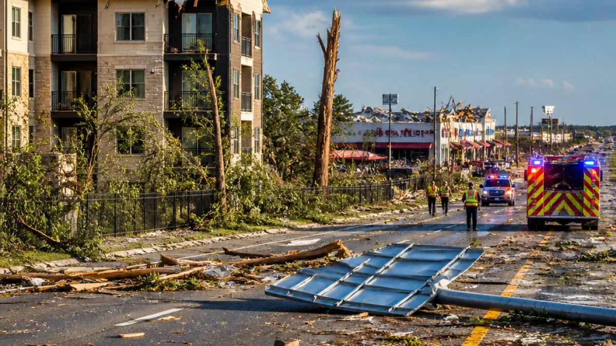
SAN ANTONIO — A tornado touched down on the far north side of San Antonio Wednesday morning, cutting across Interstate 10 and leaving a corridor of damage that included apartment rooftops, commercial properties and large trees.
Where the twister struck
The National Weather Service confirmed a tornado warning for northwest Bexar County, reporting a twister that crossed I‑10 between the The Dominion and Shavano Park neighborhoods. Local meteorologists said the vortex moved northeast and had likely dissipated by about 8:15 a.m.
- Damage reported along UTSA Boulevard, including the Oasis apartments at 6023 UTSA Boulevard.
- Retail and restaurant patios in the La Cantera area suffered awning and outdoor-structure damage.
- Large trees were snapped and uprooted in parking areas and medians; at least one water line break sent a plume into the air.
Local response and immediate impacts
First responders were on scene Wednesday morning assessing damage and making sure residents were safe. News crews and witnesses posted photos and video showing torn awnings, debris-strewn patios and damage to at least one car in a parking lot. KABB reported that the roof of an apartment complex along UTSA Boulevard was ripped.
"Seek shelter immediately,"
— the National Weather Service urged people in the storm's path as other rotating storms continued to move north and northwest from the Hill Country early Wednesday.
Why this matters for San Antonio and surrounding counties
Even brief tornadoes in developed corridors can produce concentrated damage, disrupt traffic on major arteries such as I‑10 and create hazards from downed trees and water-main breaks. The incident came amid a broader period of severe weather across Central Texas that included heavy rain and flash flooding, increasing the potential for compound impacts on infrastructure and emergency operations.
| Item | Reported |
|---|---|
| Time of likely dissipation | 8:15 a.m. |
| Notable locations | I‑10, UTSA Boulevard, La Cantera, The Dominion, Shavano Park |
| Immediate effects | Ripped apartment roof, damaged storefront patios, snapped/uprooted trees, broken water line |
Authorities and meteorologists warned residents to monitor forecasts and be prepared for additional storms in the region. Emergency crews continue to evaluate damage and safety risks along the northside corridor.
State and county officials have increasingly focused on preparedness as severe summer weather patterns — fed by Gulf moisture and stalled systems — bring heightened risk of both flooding and tornadic activity to Central and South Texas.