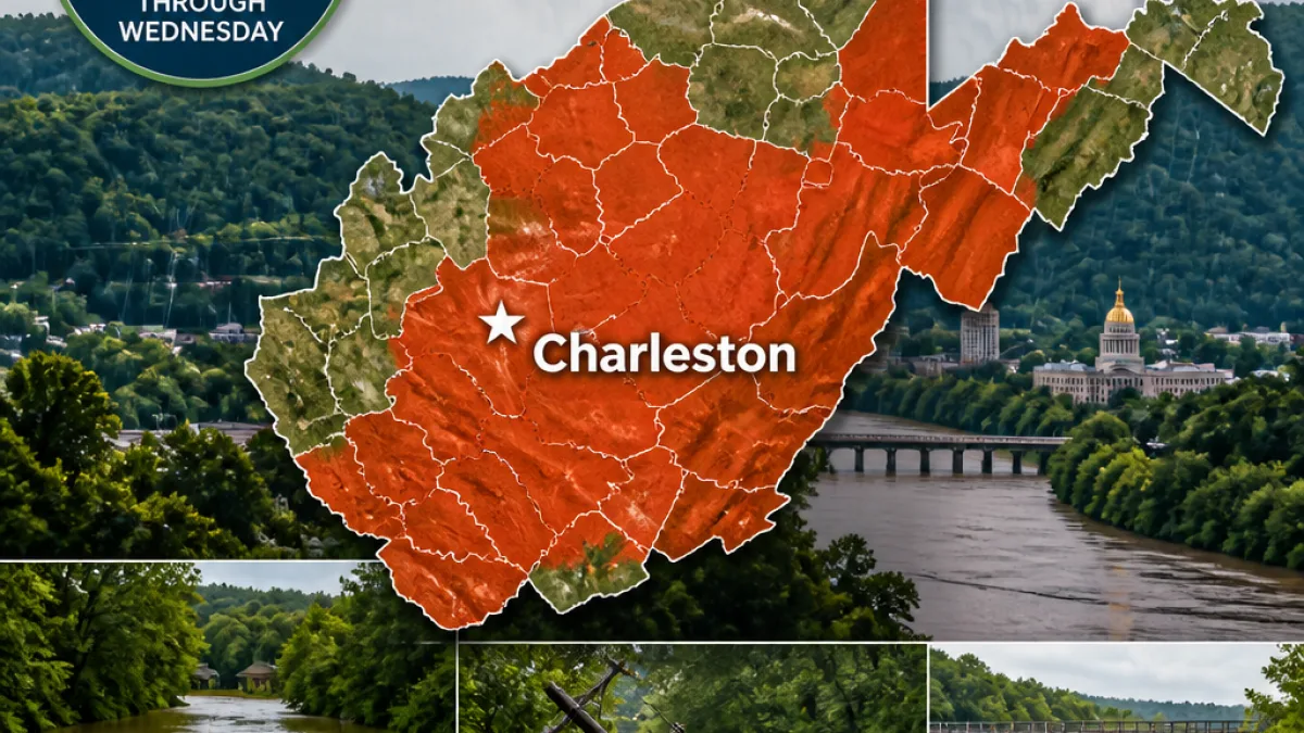
CHARLESTON, W.Va. — A flood watch that now includes 28 counties will remain in effect through Wednesday morning as a slow-moving severe weather system threatens heavy rainfall across much of the state.
What residents need to know
The National Weather Service in Charleston warned Monday that the system could produce prolonged periods of rain late Monday night into Tuesday and into Tuesday evening. Officials cautioned that areas which have already seen heavy rain recently may be especially vulnerable to additional flooding.
Counties explicitly placed under the watch include: Barbour, Boone, Braxton, Cabell, Calhoun, Clay, Doddridge, Gilmer, Harrison, Jackson, Kanawha, Lewis, Lincoln, Mason, Pleasants, Putnam, Ritchie, Roane, Taylor, Tyler, Upshur, Wirt and Wood, plus portions of Fayette, Nicholas, Pocahontas, Randolph and Webster.
- Timing: Late Monday night through Wednesday morning.
- Main hazards: Heavy rain, flash and river flooding, and ponding on roadways.
- At-risk areas: Locations that have received repeated rainfall in recent weeks, including parts of Lewis County.
Lewis County has been particularly hard hit in recent months, officials said. County Commissioner Agnes Queen described renewed water intrusion and infrastructure impacts following weekend rain.
"When we keep re-flooding, some of those individuals, especially when it runs off into their basements or to their homes, they might have minor flooding," Queen said. "For those who are trying to clean up, it makes it very difficult, especially with all the moisture. They’re trying to dry their homes out, and they keep getting re-flooded; this is the fourth flood we’ve had."
Queen told MetroNews that Sunday’s rainfall caused minor flooding, primarily in the southern and western portions of Lewis County. She reported downed power lines and roughly 30 trees blocking roadways in the county, but said there were no known injuries from the most recent storm.
Local impacts and recovery context
Lewis County remains in recovery from a major July 21 flood that prompted federal assistance through FEMA. Local officials said additional storms since that event have complicated cleanup and drying efforts, and repeated inundation risks further damage to homes and basements.
County leaders urged residents with any damage to fully document it with photographs or video for insurance or potential disaster assistance purposes. They also advised caution on travel: saturated soils and fallen trees can make roads impassable and increase the risk to motorists.
| Watch details | Area covered |
|---|---|
| Effective through | Wednesday morning |
| Number of counties | 28 (full counties + parts of 5 others) |
Safety steps for residents
Officials and emergency managers recommend residents take these precautions:
- Monitor local forecasts and updates from the National Weather Service and county emergency agencies.
- Avoid driving through flooded roadways; turn around, don’t drown.
- Move valuables and important documents from basements or low-lying areas to higher ground.
- Document any damage with photos and video for recovery or insurance claims.
The National Weather Service will continue to issue updates as the situation evolves. Local emergency management offices are available for information on road closures, sheltering options and recovery resources.
News Block will monitor developments and provide updates as additional advisories or warnings are issued.