
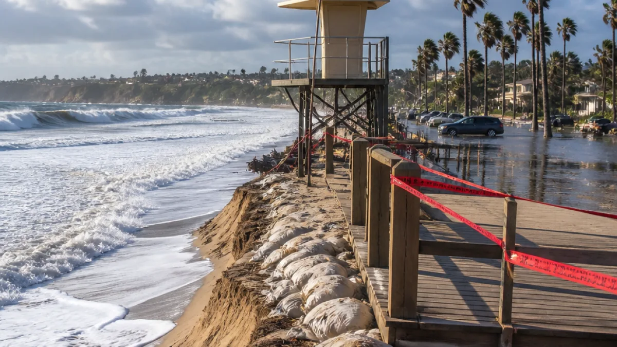
What changes for residents: The National Weather Service issued an updated beach hazards statement Friday night that covers Orange County Coastal areas from Sunday 11 a.m. through Tuesday 11 p.m. Residents and visitors should expect higher-than-normal tides, elevated surf and potential flooding of low-lying shore-side areas during the advisory window.
The NWS warned of minor coastal flooding tied to high astronomical tides of 7 to 7.5 feet, with surf to 3 to 5 feet at south-facing beaches. The agency said a 3-foot south swell, arriving from about 190 degrees with a 13–15 second period, will drive the larger surf along south-facing shores. Elsewhere along the coast, surf of 2–4 feet is expected.
Where impacts are most likely
Low-lying areas near the water — including boardwalks, beach parking lots and adjacent streets — are at the greatest risk of tidal overflow. The NWS also warned of potential beach erosion, with the highest impacts during late afternoon and evening high tides.
- Expect localized flooding of beach access points and parking lots.
- Avoid walking or driving on flooded coastal roads and boardwalks.
- Do not enter the water during the advisory: hazardous swimming and rip currents are likely.
"Areas of flooding from tidal overflow in low-lying areas, boardwalks, beach parking lots, and beach adjacent streets. Beach erosion. Highest impacts expected during high tides in the late afternoons into the evening," the NWS said.
Safety and local response
Local agencies that manage coastal access and public safety — including city beach patrols, lifeguards and county public works departments — typically monitor these events and may close access points if conditions become dangerous. Residents who frequent county beaches should watch for signs, barricades and public notices posted by lifeguards or municipal officials.
In addition to tidal overflow and erosion, the advisory cautions about hazardous swimming conditions. Strong surf and potential rip currents increase the danger for swimmers, surfers and paddleboarders. The NWS specifically urged people to remain out of the water.
| Parameter | Forecast |
|---|---|
| Advisory period | Sunday 11 a.m. to Tuesday 11 p.m. |
| High astronomical tides | 7.0–7.5 ft |
| Surf (south-facing beaches) | 3–5 ft |
| South swell | 3 ft from 190° at 13–15 sec |
| Surf (elsewhere) | 2–4 ft |
The NWS statement is in effect until Tuesday at 11 p.m. Residents planning beach visits or coastal travel should check for updated forecasts and local advisories from the National Weather Service and Orange County public safety agencies before heading to the shoreline.